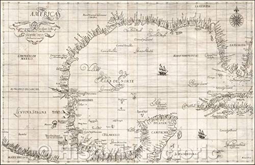
Gulf of Mexico & Florida Coast Chart 1646 - Historical Nautical Map Print - 68in x 44in

Bring historic maritime cartography to your walls with this 1646 Gulf of Mexico and Florida coast chart reproduction. Featuring copperplate engraving details, hydrographic information, coastal features, and lighthouse markers, the uncolored map is printed on heavyweight matte paper with archival inks for lasting display in homes, offices, studies, or collections.
About This Book
This historical nautical map reproduction presents the Gulf of Mexico and Florida coast as depicted in a 1646 sea chart.
The uncolored copperplate-style map includes hydrographic detail, coastal features, and lighthouse markers associated with the Enlightenment era.
Printed as fine art wall decor, it suits maritime collections, offices, studies, coastal homes, and gallery-style displays.
Heavyweight 230gsm matte paper and archival giclée inks provide crisp detail and rich tonal depth. The artwork is digitally restored to reduce age-related imperfections while preserving its historic texture and character.
Printed in the USA and packaged in a protective tube, the made-to-order print is available in sizes that fit many standard frames.
Reviews
No reviews yet. Be the first to review this book!